

Historical Markers in the Town of Queensbury
The Town of Queensbury’s historic marker program was launched during the American Bicentennial when a local citizens committee identified places where markers could be appropriately placed to interpret the town’s long and rich history. An inventory of existing markers showed that at that time the town had only a few markers. Efforts were begun to place new markers at strategic historic locations around the town.
Today there are a number of the familiar yellow and blue markers that are maintained by the Buildings and Grounds Department. The oldest of these were erected under a state sponsored program that is no longer in place. In addition, there are hamlets markers for Oneida and Harrisena, as well as, memorials for the Civil War, World War I, Korean , and Vietnam Wars. An obelisk located in front of the Town Hall denotes the Centennial of Warren County.
| #1 – Blind Rock | Located at corner of Route 9 and Montray Road – The Blind Rock marker denotes an ancient gneiss boulder which was known to Native Americans and early colonists as the bounds between lands held by the English and French prior to the French and Indian War (1754-63). On trails traversed by early natives, the rock is the legendary scene of ambushes where soldiers were sometimes waylaid. It is currently located on private property. | 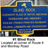 |
| #2 – Old Military Road | Located on Route 9 just north of Route 149 on west side of road, somewhat hidden – The Old Military Road from Fort Edward to Fort William Henry was 16 miles long and was cut in just 3 days by colonial soldiers under Major General William Johnson. The road followed low areas and was primitive with tree stumps over which wagon trains rode and soldiers marched. It was used by thousands of soldiers and their equipment during both the French and Indian and Revolutionary Wars. | 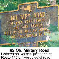 |
| #3 – Halfway Brook | Located on Route 9 at Halfway Brook on east side of the road – Halfway Brook was the sight of several fortifications during the French and Indian War. Fort Amherst was located on the south side of the brook. The blockhouse on the north side was the home of Jeffrey Cowper, the town’s first white settler. Nearby General George Washington stopped during his inspection of forts following the American Revolution and received a drink of water from Walter Briggs. | 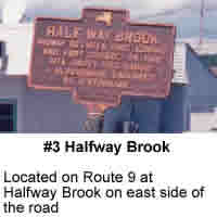 |
| #4 – Halfway Brook | Located at Hovey Pond Park on the east side of the walkway of the pond – Halfway Brook was the site of many skirmishes and ambushes during the French and Indian War. Near here Fort Amherst was erected as a fortified camp in 1757-58 and was known as the Garrison Grounds. Hence the name of Garrison Road. This large marker, erected in 1904 by the NYS Historical Society and originally located at the Corner of Route 9 and Glenwood Avenue, was moved to Hovey Pond Park in 1995 for greater public exposure. | 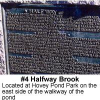 |
| #5 – Five Mile Run | Located on Route 9 across from the Great Escape on the west side of the road. On the site of the Old Military Road, this distance was five miles from Lake George. It may have been the site of French and Indian War ambushes. | 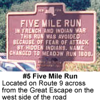 |
| #6 – Colonel Williams Monument | Located on Route 9 north of Route 149 on the east side of road. Colonel Ephraim Williams was killed in the Battle of Lake George on September 8, 1755 at age 42. He fell at the head of his column while serving under General Johnson. The monument was erected by Williams College in his memory. Williams, a New Englander, was the founder of Williams College in Massachusetts. The monument is maintained by the college today. | 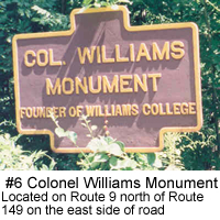 |
| #7 – Colonel Williams Grave | Located on Route 9 north of Route 149 on the west side of the road – The fenced in boulder is believed to be the site of the death of Colonel Williams, a patriot soldier who served in the French and Indian War. | 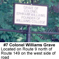 |
| #8 – Wing Memorial | Located at the Old Quaker Burying Ground southwest corner of Bay Road and Quaker Road – The Wing Family Association erected this well known monument in 1911 to the memory of Abraham and Edward Wing, Jr. Abraham Wing brought the first band of Quaker settlers to Queensbury in 1763 following the French and Indian War and became the first supervisor of the town | 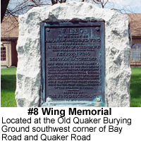 |
| #9 – Old Quaker Burying Ground | Located at the burying ground on the corner of Bay Road and Quaker Road. This site is the place where the first Quaker settlers to Queensbury built their 20 x 30 feet meetinghouse and school. Adjacent was the burial ground which holds the 80 graves of the pioneer settlers in the town. An archeological dig at this site in 1997 confirmed the presence of the cemetery. It fell into disuse around 1810. The marker was erected by the town in 1998 to perpetuate the memory of the first settlers and to preserve the site which is now on the National Register of Historic Places. | 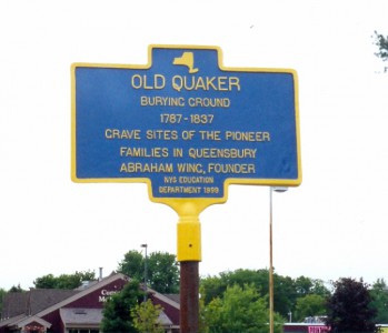 |
| #10 – Bicentennial Marker | Located at the Quaker burying ground on the corner of Bay Street and Quaker Road. Historian Howard Mason unveiled this marker during the Bicentennial of the Town in 1962 to commemorate the early settlers of the town. The Patent was also on exhibit during the celebration in which Dorothy Wing, a descendant of the early Wing family, gave the document to the town. A replica of the patent may be seen at the entrance to the Town Hall. | 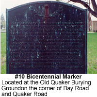 |
| #11 – Marker at entrance to Town Hall | Located in front of the Town Hall to the left of the main entrance. In 1913 on the occasion of the Centennial of Warren County, the County’s Committee presented markers to all the towns in the county noting both the town’s and the county’s beginnings. The marker has been moved several times and now stands in front of the only town hall Queensbury has had. | 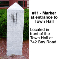 |
| #12 – Kiosk at Hovey Pond Park | Located at Hovey Pond Park on the east at far side of the walkway around the pond. The three sided kiosk tells the story of the history of Queensbury from the earliest days of the Native Americans in Early Archaic times to the development of the Park. Side exhibits change from time to time. It was dedicated by Supervisor Fred Champagne in 1998. | 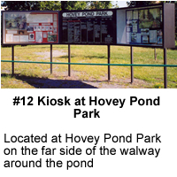 |
| #13 – Robert Eddy Botanical Gardens | Located at the English Garden on the north side of Hovey Pond Park. The Botanical Gardens were developed by local historian Robert Eddy and are modeled after old English gardens. They were named for Mr. Eddy whose work is honored by this marker. | 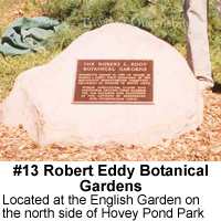 |
| #14 – Oneida Community | Located on Ridge Road in front of the Mohican Grange. The Oneida’s was the place to go to purchase supplies in the early days of lumbering in the town. Thomas Hammond, a half breed Indian was the storekeeper. | 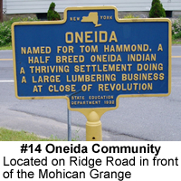 |
| #15 – Oneida Hamlet | Located on Ridge Road north of the Mohican Grange. A small green hamlet marker notes the small but the thriving community of The Oneida which was settled in the nineteenth century. Many of the old homes are still in the community which ran east and west along Sunnyside Road. | 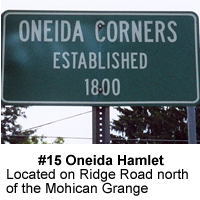 |
| #16 – Harrisena Hamlet | Located on east side of Ridge Road north of Route 149. This smaller hamlet marker locates one of the town’s many small hamlets that grew up during the nineteenth century. The area was dotted with many farms and apple orchards. Harrisena Community Church is north of here along with the hamlet of Brayton. | 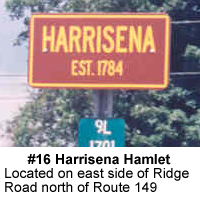 |
| #17 – French Mountain Hamlet | Located on west side of Route 9 at intersection with Route 149. French Mountain hamlet was a thriving community in the late 19th century. The well known Halfway House run by George Brown was a stop on the stagecoach run to Warrensburg. It burned in 1947 and today it is the site of the Super Shoe Store in the Million Dollar Mile Malls of Queensbury. | 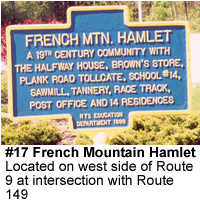 |
| #18 – Scotch Church | Located on Bay Road south of Route 149 on the west side of the road. The Scotch Presbyterian Church was erected in 1854 by the Scottish settlers to the Top O’ The World. These immigrants came directly from borderlands of southern Scotland and made their farms on the heights overlooking Lake George. Many of their descendants reside in Queensbury today. | 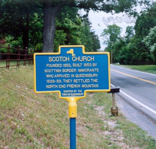 |
| #19 – Airport and Queensbury School | Located on Aviation Road in front of the Queensbury School Complex. The town’s first airport (operated by the city of Glens Falls) was located on this site. The first of the campus buildings was opened in 1950 and housed grades K-12. | 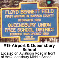 |
| #20 – Morgan’s Ford | To be erected in South Queensbury. This ford is the site of the place that troops of General Burgoyne crossed the Hudson River during the Three Fold Campaign of the American Revolution. Burgoyne went on to defeat at the Battle of Saratoga in October 1777. | 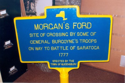 |
| #21 – Queensbury Soldiers Monument | Located in Glens Falls at intersection of Glen, Bay, and South Streets. The Soldiers Monument was erected to the 644 men who served from Queensbury in the Civil War from 1861-65. The names of 95 men who died in battle or from wounds or disease are engraved on the monument. Made of sandstone, it has undergone three preservation efforts since it dedication in 1872. The last restoration was in 1999 and resulted in the replacement of the large sandstone eagle on the top with a terra cotta replica. The monument became the property of the city of Glens Falls when it was chartered in 1908. | 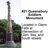 |
| #22 – Peace and Victory Monument | Located in Crandall Park on upper Glen Street. The Peace and Victory Monument was erected in 1927. A bronze figure sculpted by Bruce Wilder Scoville of New York City is a tribute to the men from the Town of Queensbury and the City of Glens Falls who gave their lives from the Civil War to the Korean War. Names have been added over time. | 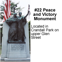 |
| #23 – Korean Veterans Memorial | Located in Crandall Park on Upper Glen Street. The Korean Veteran’s Memorial names soldiers from seven area communities who died or are missing in action from 1950-53 Asiatic war. | 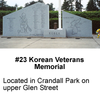 |
| #24 – Vietnam Veterans Memorial | Located at Adirondack Community College on Bay Road in front of the Science Building on left hand side. The Vietnam Memorial is dedicated to the 58 area men who gave their lives during this bitterly contested South Asia conflict. | 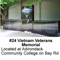 |
| #25 – Mountainside Free Library | Located on north side of Route 9L west of Bay Road. The Mountainside Library was built with funds from Andrew Carnegie on land donated by Elwyn Seelye, son-in-law of Edward Eggleston. The library is unique in that it is always open to the public using the honor system. The Friends of Mountainside Library oversee the facilities operation. | 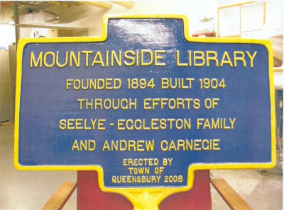 |
| #26 – Jenkins Mills | Located in the hamlet of Jenkinsville on Jenkinsville Road off Ridge Road South of Route 149. The hamlet was a 19th century settlement at a mill pond with several mill businesses. It was also the home of DeWitt Clinton Jenkins, barns builder and the Civil War soldier Solomon King Stewart, Corporal Co.I 91st Regiment NY Infantry. | 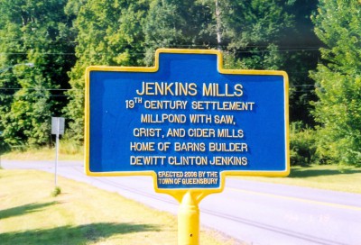 |
| #27 – District 10 Schoolhouse | Located on the northeast side of Bay Road and Route 149 intersection. This one room school housed grades 1-8 from 1805 to 1948 after which it was sold to private owners. | 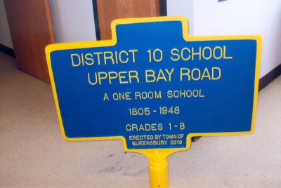 |
| #28 – Hamilton Lodge | Located on the south side of Sunnyside Road near the intersection of Ridge Road and Sunnyside Road. Near here the first permanent Masonic Lodge in Queensbury was warranted in 1804. Hamilton Lodge 144 F & AM was named for Alexander Hamilton. | 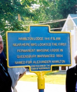 |
| #29 – Billy Buckingham Memorial | Located on the north side of Aviation Road in front of Queensbury High School. While crossing Aviation Road at Westmore Avenue on the afternoon of Monday August 18, 1980, fourteen year old Billy Buckingham, Jr.’s bicycle was hit by a car and he was killed. Billy was the son of Mr. and Mrs. William B. Buckingham of Sylvan Avenue. He would have entered ninth grade at Queensbury High School in the fall. | 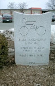 |
| #30 – Veteran’s Memorial | Located at Hovey Pond Park entrance on the left on Lafayette Street. This marker honors men and women from all branches of the military and the Coast Guard for their service to our country. | 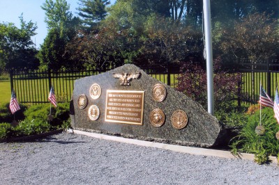 |